Estimated Tornado Path??
on Monday April 18, 2011 09:32AM
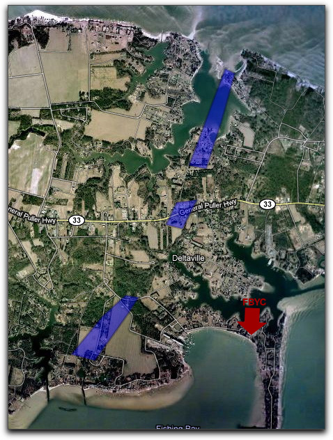 Based on personal observations yesterday and the WAVY aerial video http://www.wavy.com/dpp/news/local_news/chopper-10:-storm%27s-aftermath I am guessing that the blue shapes on this google map show the path the tornado followed.
 You can look at the Google map here.